
Waterfalls Brisbane: 7 Falls Walks Near the City
Published 26 October 2026
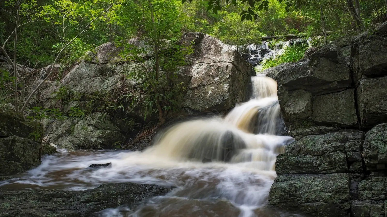
Photo: Lenny K Photography from Sydney, Australia, CC BY 2.0, via Wikimedia Commons.
You don't need to leave Brisbane to find a waterfall. JC Slaughter Falls and Simpsons Falls are both in Mt Coot-tha Forest, and the Summit Track links JC Slaughter Falls to a café-topped lookout in about 30 minutes. With a full day, D'Aguilar National Park, the Blackall Range and Main Range add bigger drops. This guide covers seven waterfalls in and near Brisbane, with track details from Brisbane City Council and Queensland Parks and Wildlife Service (QPWS), checked on 25 October 2026.
One thing to know first: most falls near Brisbane are rain-fed. Brisbane City Council (BCC) says Simpsons Falls has "rock ledges and trickles of water during the dry months, and a flowing waterfall after heavy rain". Plan your visit for a few days after decent rain, and check track alerts first.
Note: Tamborine and Springbrook waterfalls on the Gold Coast hinterland are deliberately left out. They're covered in our separate Gold Coast waterfall walks guide.
Waterfalls near Brisbane at a glance
| Waterfall | Where | Walk | Grade / time | Best for |
|---|---|---|---|---|
| JC Slaughter Falls | Mt Coot-tha Forest | From the picnic area | Easy | Picnics, the Summit Track |
| Simpsons Falls | Mt Coot-tha Forest | 650 m | 40 min, moderate fitness | A quick fix after rain |
| Greenes Falls | D'Aguilar NP (Maiala) | 4.3 km return | Grade 3, 2 hr | Rainforest and pools |
| Bulls Falls lookouts | D'Aguilar NP (Mount Mee) | 1 km return | Grade 2, 30 min | An easy view |
| Kondalilla Falls | Kondalilla NP | 4.7 km circuit | Grade 3, 2–3 hr | A 90 m drop |
| Queen Mary Falls | Main Range NP | 2 km circuit | Grade 3, 40 min | Top and base views |
| Araucaria Falls | Main Range NP (Goomburra) | 3.6 km return | Grade 4, 1.5 hr | Quiet rainforest |
Waterfalls in Brisbane: Mt Coot-tha Forest
1. JC Slaughter Falls
JC Slaughter Falls is Brisbane's best-known waterfall and the hub of Mt Coot-tha Forest. The J.C. Slaughter Falls picnic area is the start of several popular tracks:
- Summit Track (#58): 1.9 km and about 30 minutes each way to Mt Coot-tha Lookout. BCC calls it "arguably the mountain's most popular hike", "a relatively easy walk" and "perfect for all fitness levels". There's a café at the lookout. BCC's Mt Coot-tha track page describes it as a mostly paved path with some stairs.
- Mahogany Trail (#66): 2.6 km through open eucalypt forest with city glimpses, ending near the lookout. It's a shared-use track with bikes and horses. Join the Citriodora Trail via the Summit Track for a 4.5 km circuit.
- Discovery Trail (#70): 1.6 km (30 minutes), linking the Simpsons Falls, JC Slaughter Falls, Hoop Pine and Silky Oak picnic areas.
That makes it easy to pair a waterfall stop with a summit walk. See BCC's beginners' guide to walking Mt Coot-tha.
Is JC Slaughter Falls flowing? Like Simpsons Falls, it depends on recent rain. In dry spells, expect rock ledges rather than a curtain of water.
2. Simpsons Falls
The Simpsons Falls track is 650 m and takes about 40 minutes. BCC says you need moderate fitness. It connects to the Eugenia Circuit (2.8 km) and the Stringybark Track. BCC describes it this way: "Every visit to the falls is different." Go after heavy rain for the best flow.
Waterfalls near Brisbane: D'Aguilar National Park
3. Greenes Falls (Maiala)
In the Maiala area of D'Aguilar, about 42 km from the city, the 4.3 km return Grade 3 track (about 2 hours) passes "crystal-clear pools, strangler figs, abundant wildlife and a small cascading waterfall", according to QPWS's D'Aguilar walking tracks. It's a classic Brisbane rainforest walk.
4. Bulls Falls (Falls lookout track, Mount Mee)
In D'Aguilar's northern Mount Mee section, the Falls lookout track is 1 km return, Grade 2, and takes about 30 minutes. It leads to two lookout points with views of Bulls Falls. It's a viewing walk, not a swimming spot.
D'Aguilar alerts: When we checked, QPWS listed temporary closures at Bellbird Grove (22–27 October 2026) and Scrub Road causeway works (14–30 October 2026). Check park alerts before you drive.
Day trips: bigger waterfalls near Brisbane
5. Kondalilla Falls (Sunshine Coast hinterland)
QPWS says Skene Creek drops 90 m at Kondalilla Falls. The 4.7 km Grade 3 circuit (2–3 hours) has over 300 stairs. A shorter option is Mapleton Falls, where the Wompoo circuit is 1.3 km and Grade 2, and Pencil Creek drops 120 m.
6. Queen Mary Falls (Main Range)
The 2 km Grade 3 circuit (about 40 minutes) runs through changing forest to the top, and then the base, of Queen Mary Falls, according to QPWS's Main Range walking tracks. Alert: QPWS listed a temporary track closure from 21 to 26 October 2026.
7. Araucaria Falls (Goomburra, Main Range)
This 3.6 km return Grade 4 track (about 1.5 hours) is flanked by subtropical rainforest. Note that QPWS lists the Cascades and Dalrymple circuits in the Goomburra section as temporarily closed until 31 December 2026.
When to visit waterfalls near Brisbane
South-east Queensland's waterfalls are at their best in the warmer, wetter months, and a day or two after a solid downpour. In long dry spells, smaller falls like JC Slaughter and Simpsons can shrink to a trickle. The bigger escarpment falls, like Kondalilla, Mapleton and Queen Mary, are more reliable but still vary a lot. Wet weather also brings track closures. QPWS closes Blackall Range tracks during severe wet weather, so the ideal window is after the rain has eased and the alerts have cleared. Go early on weekends: picnic areas at Mt Coot-tha and Maiala fill quickly on sunny days. Pack water, sturdy shoes with grip and insect repellent, as rock and timber near falls stay slippery even in sunshine.
Waterfall safety
- Stay behind fences and off cliff edges. QPWS warns that people have died or been permanently paralysed after slipping over waterfalls in Blackall Range parks.
- Don't cross flooded creeks. Water rises and falls quickly. Wait until it no longer covers the track.
- Check the forecast with the Bureau of Meteorology and current QPWS park alerts.
- Dogs: They aren't allowed in Queensland national parks. Check council rules for Mt Coot-tha.
Want more walks? Browse all Active Quests trails or start from the Active Quests home page.
Related guides
- Waterfalls Sunshine Coast: Kondalilla, Mapleton & More
- Lamington National Park Trails: 12 Best Walks by Section
- Dog Friendly Hikes Brisbane: 6 Leashed-Dog Bush Walks
- Gold Coast Waterfall Walks
Browse every Brisbane walking track and hiking trail on Active Quests.
Frequently asked questions
Where is JC Slaughter Falls?
It's in Mt Coot-tha Forest in Brisbane's west, at the J.C. Slaughter Falls picnic area. The Summit Track (1.9 km) and Mahogany Trail (2.6 km) both start here and lead to Mt Coot-tha Lookout.
Is JC Slaughter Falls flowing right now?
It depends on recent rain. BCC says nearby Simpsons Falls has trickles in dry months and a flowing waterfall after heavy rain. Visit a few days after a good downpour.
What is the closest waterfall to Brisbane CBD?
JC Slaughter Falls and Simpsons Falls in Mt Coot-tha Forest are the closest major waterfall walks to the CBD.
What is the best waterfall near Brisbane for a day trip?
Kondalilla Falls (a 90 m drop) and Queen Mary Falls are the standouts. Greenes Falls in D'Aguilar is the closest rainforest waterfall walk.
Can you swim at waterfalls near Brisbane?
Follow on-site signs and QPWS advice. Many falls are viewing-only, and you should never enter water near a cliff edge or after heavy rain.
What is the easiest waterfall walk near Brisbane?
The Falls lookout track to Bulls Falls (1 km return, Grade 2) and the Wompoo circuit at Mapleton Falls (1.3 km, Grade 2) are both short and easy.
Tours & experiences near Brisbane
Chase waterfalls, collect check-ins
Each waterfall in the table is a GPS check-in quest. Walk it, check in at the falls and earn ACTIVE Coins. Get Active Quests on the App Store.