
Kondalilla Falls Circuit: Distance, Stairs, Rock Pools and Planning Tips
Published 29 October 2026
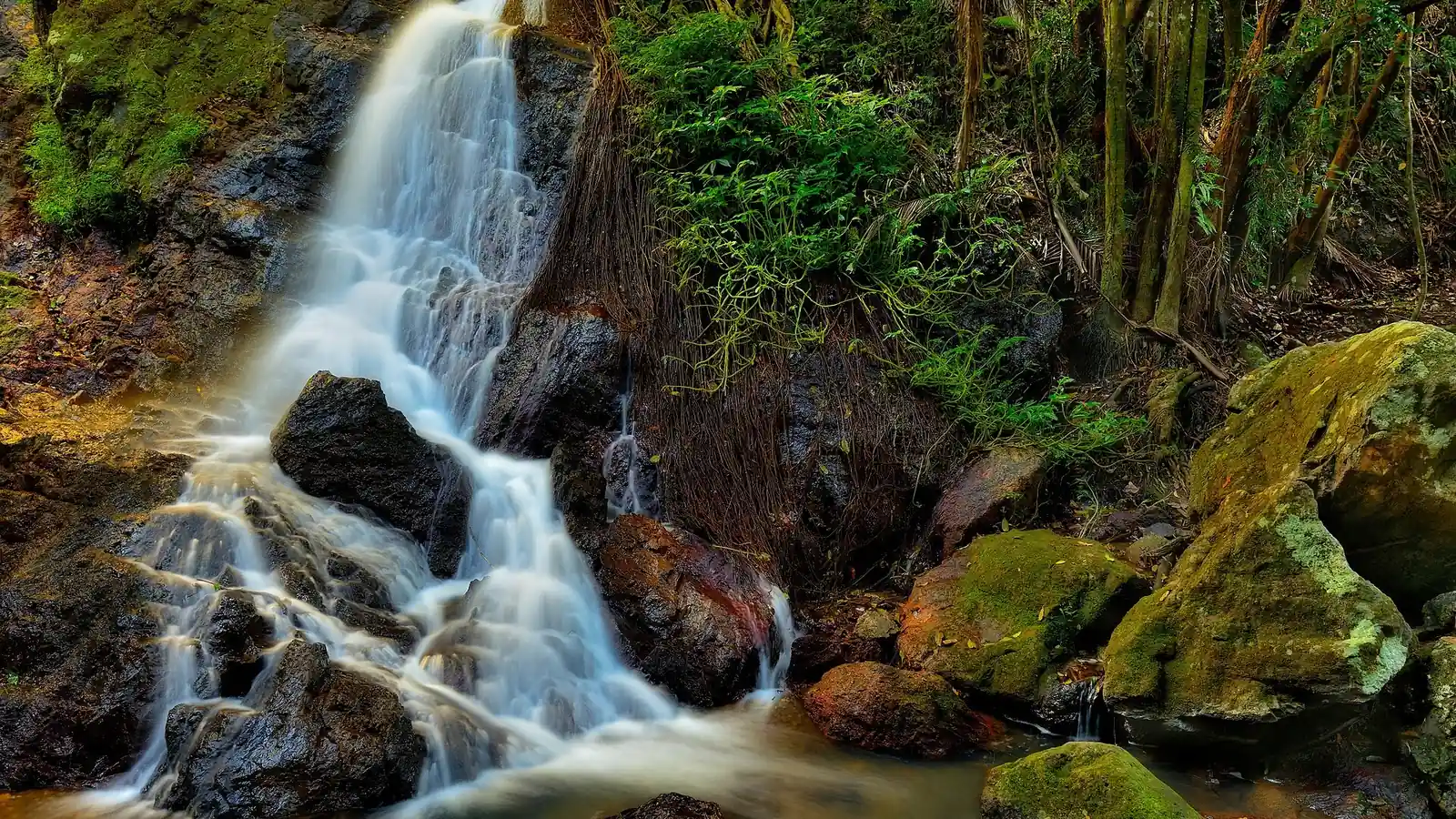
Photo: Kondalilla Falls, by Andrii Slonchak, CC BY 2.0, via Wikimedia Commons. Cropped to fit.
Kondalilla Falls is one of the best-known waterfall walks in the Sunshine Coast Hinterland. The name comes from an Aboriginal word meaning "rushing water", and Queensland Parks and Wildlife Service (QPWS) says the main fall plunges 90 m into a rainforest valley. This guide covers the Kondalilla Falls circuit, the easier Picnic Creek circuit, what the stairs are really like, and how to plan a visit to Kondalilla National Park near Mapleton.
Quick answer: the Kondalilla Falls circuit
- Distance: 4.7 km circuit, according to QPWS.
- Time: allow 2 to 3 hours.
- Grade: Grade 3. QPWS says Grade 3 tracks are formed, "may have short steep hills and many steps" and suit walkers with some experience.
- Stairs: over 300. QPWS says "what goes down must come back up", so you need to be reasonably fit.
- Start: the picnic area, reached by a short downhill walk with steps from the Kondalilla Falls Road car park.
- Highlights: rock pools, a lookout over Kondalilla Falls, rainforest and the base of the waterfall.
Kondalilla National Park walks at a glance
| Walk | Distance | Grade | Time | Best for |
|---|---|---|---|---|
| Picnic Creek circuit | 1.7 km | Grade 2 | 45 minutes to 1 hour | Families, shorter legs, a gentle first walk |
| Rock pools (out and back on the falls circuit) | About 2.4 km return (QPWS map) | Grade 3 | Allow extra time for the stairs | A shorter taste of the falls circuit |
| Kondalilla Falls circuit | 4.7 km | Grade 3 | 2 to 3 hours | Full waterfall experience, confident walkers |
The rock pools distance is the one number sources disagree on. The QPWS park map lists 2.4 km return, while the Adventure Sunshine Coast listing from Sunshine Coast Council gives a slightly longer figure of about 2.7 km. Treat it as roughly 2.5 km and allow a little extra time.
Picnic Creek circuit: the easy option
The 1.7 km Picnic Creek circuit is a Grade 2 walk. QPWS says it crosses Picnic Creek, passes through tall eucalypt forest with patches of wet sclerophyll forest (a mix of eucalypt and rainforest species), and has views over the valley from a lookout. Allow 45 minutes to an hour.
It's also the first section of the longer falls circuit, so you can start here and decide whether to continue. If you want to log it as a quest, there's a separate Picnic Creek circuit quest.
Kondalilla Falls circuit: what to expect
QPWS describes the route as following the Picnic Creek circuit down the escarpment, past rock pools and a lookout with views of the falls. The track then continues through rainforest to the base of the waterfall before climbing back up the ridge.
- Picnic area to the creek. The first section is the gentler part and is shared with the Picnic Creek circuit.
- Rock pools and the lookout. The rock pools sit above the falls, so keep well back from edges and stay behind safety fences.
- The descent. The 300-plus stairs on the circuit include the steep, curving steps down to the best view of the falls.
- The base of the falls. You'll find boulders, a pool and the full height of the waterfall above you.
- The climb out. The route returns up the ridge. Take it slowly and save some water and energy for this section.
Along the way QPWS points out bunya pines, dense stands of piccabeen palms and pink ash trees. It lists possums, pademelons, wallabies, goannas, platypus, echidnas and more than 107 bird species in the Blackall Range rainforests, so go quietly and keep an eye out.
You can track the walk with the Kondalilla Falls Circuit quest.
Is the Kondalilla Falls walk hard?
For most active adults it's a moderate walk with a hard climb at the end. The distance is short, but the descent and ascent are stairs-heavy, so it feels harder than 4.7 km on flat ground. If you have knee problems, small children or limited time, start with the Picnic Creek circuit or walk only as far as the rock pools.
For context, the Australian Government's guidelines recommend that adults aged 18 to 64 accumulate 150 to 300 minutes of moderate-intensity physical activity a week. A brisk bushwalk like this can count towards that. For more on the benefits, read our guides on the benefits of walking and the physical activity guidelines in Australia.
When to visit Kondalilla Falls
QPWS's ranger tip is that the waterfall flows all year, but it's thundering and spectacular during the summer rainy season and dies to a gentle trickle in the drier winter months. So if you want a full-flow waterfall, aim for a day or two after summer rain. If you want cooler, drier walking, choose the drier months and accept a lighter flow.
Wet weather also affects access. QPWS warns not to cross flooded creeks and says water levels rise and fall quickly. Tracks and parks can close in severe weather, so check the QPWS park alerts before you leave. Start early enough to finish in daylight, as QPWS advises.
Getting there and facilities
Kondalilla National Park is about 103 km north of Brisbane, near Montville and Mapleton. QPWS says to follow the Montville–Mapleton Road and turn into Kondalilla Falls Road. QPWS says bitumen roads lead to the park.
From the car park, a short downhill walk with steps leads to a large grassed picnic area. There are toilets, picnic tables, barbecues and shelter sheds, and all the walking tracks start from the picnic area. Plan around the steps, as there's no step-free start.
Camping near Kondalilla Falls
There's no vehicle-accessible camping in Kondalilla National Park. QPWS says the only camping is at Flaxton walkers' camp, a bush camp for walkers on the 58 km Sunshine Coast Hinterland Great Walk. If you want a bed for the night nearby, you'll need to look at accommodation in Montville, Mapleton or Maleny.
Safety at Kondalilla Falls
- Stay behind the fences. The QPWS park map warns of sheer cliffs and slippery rocks near the waterfalls.
- Don't dive or jump. QPWS lists a dip in the rock pool as a highlight, but you swim at your own risk and should follow park signs.
- Supervise children closely near the creek and lookouts.
- Wear grippy shoes and carry water. Steps and rocks stay slippery after rain.
- In an emergency, call Triple Zero (000), as printed on the QPWS park map.
New to longer bushwalks? Our hiking essentials checklist and hiking for beginners guide cover what to pack and how to pace yourself.
Other walks near Kondalilla Falls
- Mapleton Falls National Park. QPWS says the Mapleton Falls lookout is a 50 m return walk with views over the Obi Obi gorge, and the nearby Wompoo circuit is about 1.5 km. See the Wompoo Circuit quest.
- Sunshine Coast Hinterland Great Walk. The QPWS map lists Narrows Lookout at 2.2 km return and Baroon Lookout at 4.4 km return, both accessed via Narrows Road. See the Lake Baroon section quest.
- Mary Cairncross, Maleny. A rainforest walk a short drive away. See the Mary Cairncross rainforest walk quest.
For more day trips, browse our Sunshine Coast hikes and Sunshine Coast waterfall walks guides, or see every Active Quests trail.
Want more walks nearby? Browse the Sunshine Coast hikes and walking trails hub, from the Noosa coastal walk to the Glass House Mountains.
Frequently asked questions
How long is the Kondalilla Falls walk?
QPWS lists the Kondalilla Falls circuit as 4.7 km and says to allow 2 to 3 hours. The shorter Picnic Creek circuit is 1.7 km and takes 45 minutes to an hour.
How many stairs are there at Kondalilla Falls?
QPWS says there are over 300 stairs on the Kondalilla Falls circuit, so you need to be reasonably fit. You'll meet them on the way down to the base of the falls and again on the climb back out.
Can you swim at Kondalilla Falls?
QPWS lists a dip in the rock pool as a highlight, but it also warns of sheer cliffs and slippery rocks near waterfalls. Stay behind safety fences, never dive or jump, follow park signs and check park alerts before you go.
Is Kondalilla Falls suitable for kids?
The Picnic Creek circuit is Grade 2 and suits most children. The full falls circuit is Grade 3 with over 300 stairs, so it suits older children who can handle steps and a steep climb out. Supervise children closely near cliffs and water.
Can you camp at Kondalilla National Park?
No vehicle-accessible camping is available. The only camping is at Flaxton walkers' camp, which is for walkers on the 58 km Sunshine Coast Hinterland Great Walk.
When is the best time to see Kondalilla Falls?
The waterfall flows all year, but QPWS says it's at its most spectacular in the summer rainy season and slows to a trickle in the drier winter months. Check park alerts first, as wet weather can close tracks.
Tours & experiences near Noosa & Sunshine Coast
Earn as you explore
Active Quests turns walks into GPS check-in quests where you earn ACTIVE Coins on the trail. Get it on the App Store.