
Girraween National Park: Best Walks, The Pyramid and Camping
Published 27 October 2026
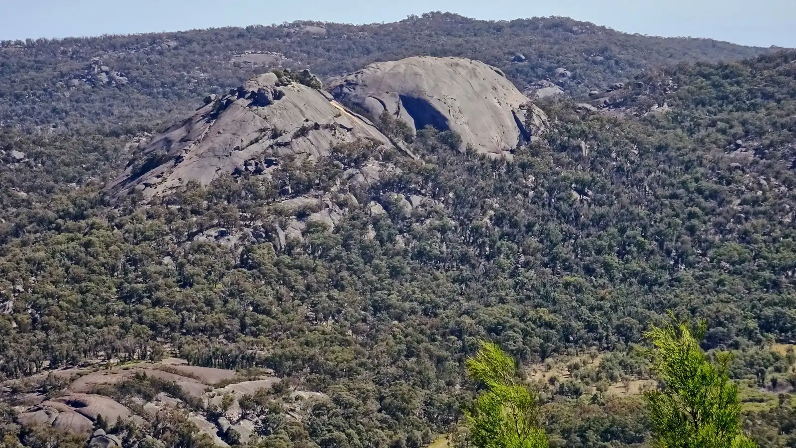
Photo: Tatters ✾ from Brisbane, Australia, CC BY-SA 2.0, via Wikimedia Commons, cropped to 16:9.
Girraween National Park sits on the Queensland–New South Wales border, about 260 km by road (roughly 3.5 hours) south-west of Brisbane, halfway between Stanthorpe and Tenterfield. Queensland Parks and Wildlife Service (QPWS) says the name means "place of flowers". It describes a park of "massive granite outcrops, large angular tors, and precariously balanced boulders", with big wildflower displays in spring. This guide covers the best Girraween walks, camping and planning tips, using QPWS details checked on 27 October 2026.
Girraween National Park walks at a glance
| Walk | Distance | Time | Grade | Starts at |
|---|---|---|---|---|
| Wyberba walk | 280 m one way | 15 min | Grade 2 | Bald Rock Creek day-use area |
| Dr Roberts Waterhole | 1.2 km return | 30 min | Grade 2 | Dr Roberts car park |
| Underground Creek track | 2.8 km return | 1.5 hr | Grade 3 | Dr Roberts car park |
| Bald Rock Creek circuit | 2.2 km circuit | 1 hr | Grade 3 | Bald Rock Creek day-use area |
| Creek trail (shared with bikes) | 3.5 km circuit | 1 hr | Grade 3 | Southern trails (see QPWS map) |
| The Junction | 5.2 km return | 2 hr | Grade 3 | Bald Rock Creek day-use area |
| The Pyramid | 3.6 km return | 2 hr | Grade 4 | Bald Rock Creek day-use area |
| Castle Rock | 5.2 km return | 1.5–2 hr | Grade 4 | Near the visitor information building car park |
| The Sphinx and Turtle Rock | 7.4 km return | 3–4 hr | Grade 3 | Near the visitor information building car park |
| Peak trail (shared with bikes) | 10.6 km return | 2 hr | Grade 3 | Mount Norman day-use area |
| Mount Norman | 11 km return (4 km from Mount Norman day-use area) | 4–5 hr (1.5–2 hr) | Grade 4 | Visitor information building or Mount Norman day-use area |
Check alerts first. At the time of writing, QPWS listed two Girraween alerts. The northern walking tracks were closed due to flooding on 26–27 October 2026, and swimming in Bald Rock Creek is prohibited from 26 October to 6 November 2026. Always check Girraween park alerts before you go.
The Pyramid: Girraween's signature climb
3.6 km return · 2 hours · Grade 4
The Pyramid is the walk most people come for. QPWS calls it "a strenuous walk to the top of this massive granite dome for breathtaking views over the park". The track starts at the Bald Rock Creek day-use area, passes Granite Arch, and winds uphill through eucalypt forest to the base of the dome.
The last section is a steep climb up exposed granite. QPWS says you need "a good level of fitness and stamina", and its FAQ is blunt: there are no ropes to help you up, so it's your call whether you can handle it. At the top, rest under the famous Balancing Rock and look across to the Second Pyramid. Don't climb when the rock is wet. QPWS warns that granite gets extremely slippery in rain.
Check in along the way with our Pyramid quest.
Granite Arch, Wyberba walk and Bald Rock Creek
These easy walks all start around the Bald Rock Creek day-use area. It has a view of The Pyramid, free electric/fuel barbecues, picnic tables and flush toilets.
- Granite Arch. QPWS says this arch, formed by huge balancing boulders, is "one of the park's most-photographed views". It's a short detour (about 250 m) off the Bald Rock Creek circuit. Quest: Granite Arch.
- Wyberba walk (280 m one way, Grade 2). A stroll beside Bald Rock Creek to a lookout facing The Pyramid. QPWS suggests looking for cormorants, wood ducks, fairy-wrens and Girraween's Bell's turtle. Quest: Wyberba walk.
- Bald Rock Creek circuit (2.2 km, Grade 3). Rock pools, stepping-stone creek crossings and spring wildflowers, looping back past the camping area. Quest: Bald Rock Creek circuit.
- The Junction (5.2 km return, Grade 3). An easy ramble along Bald Rock Creek with rock pools, spring wildflowers and lots of birdlife. Quest: The Junction.
Castle Rock, The Sphinx and Turtle Rock
Castle Rock: 5.2 km return · 1.5–2 hours · Grade 4
Castle Rock climbs through shady eucalypt woodland along rocky ridges. It finishes with a steep scramble over exposed granite to what QPWS calls "jaw-dropping 360-degree views across the park". Quest: Castle Rock.
From the Castle Rock track, a branch leads along the ridge top to The Sphinx, a granite pinnacle topped by a massive balancing tor, and Turtle Rock, a monolith shaped like a turtle's back. The Sphinx and Turtle Rock walk is 7.4 km return. QPWS says to allow around 4 hours to combine Castle Rock, The Sphinx and Turtle Rock. Quest: The Sphinx and Turtle Rock.
Mount Norman: the highest peak
11 km return from the visitor information building, or 4 km return from Mount Norman day-use area · Grade 4
Mount Norman is Girraween's highest peak at 1267 m. The long route passes Castle Rock and heads deep into tall forest, with views of the Eye of the Needle on the mountain's northern face. A shorter 4 km return option starts at the Mount Norman day-use area in the south of the park. It's reached by a separate road from Wallangarra. Note that the track stops at the base of the monolith. QPWS says the final approach to the summit is for rock climbers only. Quest: Mount Norman.
Quieter walks and bike trails
- Dr Roberts Waterhole (1.2 km return, Grade 2). A gentle walk to a deep, still waterhole on Bald Rock Creek. QPWS says it's named after a Stanthorpe doctor whose campaigning led to the park being established. Quest: Dr Roberts Waterhole.
- Underground Creek track (2.8 km return, Grade 3). This walk continues on from Dr Roberts Waterhole through swamp, woodland and shrubland. It ends where Bald Rock Creek seems to vanish under fallen boulders, then reappears downstream. Quest: Underground Creek track.
- Creek trail and Peak trail. These are the park's shared walking and mountain bike trails. QPWS says mountain bikes are allowed only on council roads and the Peak and Creek trails, not on other walking tracks.
Girraween National Park camping
QPWS runs three main camping areas, all reached by sealed road:
- Castle Rock camping area: sites for tents, small caravans and camper trailers, plus dedicated sites for people with disabilities.
- Kambuwal camping area: shady sites among granite boulders with views of The Pyramid, suitable for tents, small caravans and camper trailers.
- Terrawambella camping area: open, spacious sites for large caravans and motorhomes. Its tent area is for large organised groups only.
Camping permits must be booked and paid for online before you arrive. QPWS says bookings can't be made at the visitor centre or in the camping areas, so book early for school holidays and long weekends. There are no powered sites, generators aren't allowed, and pets aren't permitted in the park. Remote bush camping is also allowed for experienced walkers with good navigation skills (restrictions apply). See Girraween camping for site details.
When to visit Girraween
QPWS says Girraween "has more in common with cooler southern climes than with the Sunshine State".
- Spring (and summer) is wildflower season. Most species flower in spring, and flannel flowers and orchids carry on through summer.
- Winter is dry, cold and frosty. Nights average a minimum of 1°C and can drop to −8°C. QPWS says the park gets some sleet or snowflakes most years, though snow rarely settles.
- Summer days are a warm 25–30°C, with cooler nights averaging 15°C. Most rain falls between November and March.
Planning tips
- Getting there: turn off the New England Highway 26 km south of Stanthorpe or 30 km north of Tenterfield. The road is sealed all the way to the visitor information building, so a 2WD is fine.
- Bring drinking water. QPWS says taps provide only unfiltered creek water.
- Mobile reception is limited. There's a public phone near the visitor information building, and QPWS suggests screenshotting directions before you go.
- No bins. Take all rubbish home.
- Never dive or jump into Bald Rock Creek. Water depths vary and there are submerged rocks and logs.
- Bald Rock is nearby. Bald Rock National Park is just over the border in NSW. There's no direct road between the parks, and QPWS says it takes about an hour via Tenterfield or Stanthorpe.
New to bigger walks? Read our hiking essentials checklist and hiking for beginners guide. For closer day trips, see our hikes near Brisbane and Lamington National Park trails guides, or browse every Active Quests trail.
Frequently asked questions
Where is Girraween National Park?
It's on the Queensland–New South Wales border, about 260 km (roughly 3.5 hours' drive) south-west of Brisbane, halfway between Stanthorpe and Tenterfield.
How long is The Pyramid walk at Girraween?
QPWS lists The Pyramid as 3.6 km return, about 2 hours and Grade 4. The final section is a steep climb on exposed granite with no ropes.
Do you need a 4WD for Girraween National Park?
No. QPWS says the road is sealed all the way into the park from the New England Highway. A 4WD council road crosses the park, but you don't need it for the main walks or camping areas.
Can you swim at Girraween National Park?
Usually, yes. Rock pools along Bald Rock Creek are popular in the warmer months, but never dive or jump in. Swimming in Bald Rock Creek is prohibited from 26 October to 6 November 2026, so check park alerts before you go.
Can you camp at Girraween?
Yes. Castle Rock, Kambuwal and Terrawambella camping areas must be booked and paid for online in advance. There are no powered sites and generators and pets are not allowed.
When is the best time to visit Girraween?
Spring is best for wildflowers. Winter brings crisp, clear days but frosty nights that can fall to −8°C.
Tours & experiences near the Scenic Rim
Earn as you explore
Active Quests turns walks into GPS check-in quests where you earn ACTIVE Coins on the trail. Get it on the App Store.