
Minyon Falls Walk: The Complete Track Guide
Published 26 October 2026
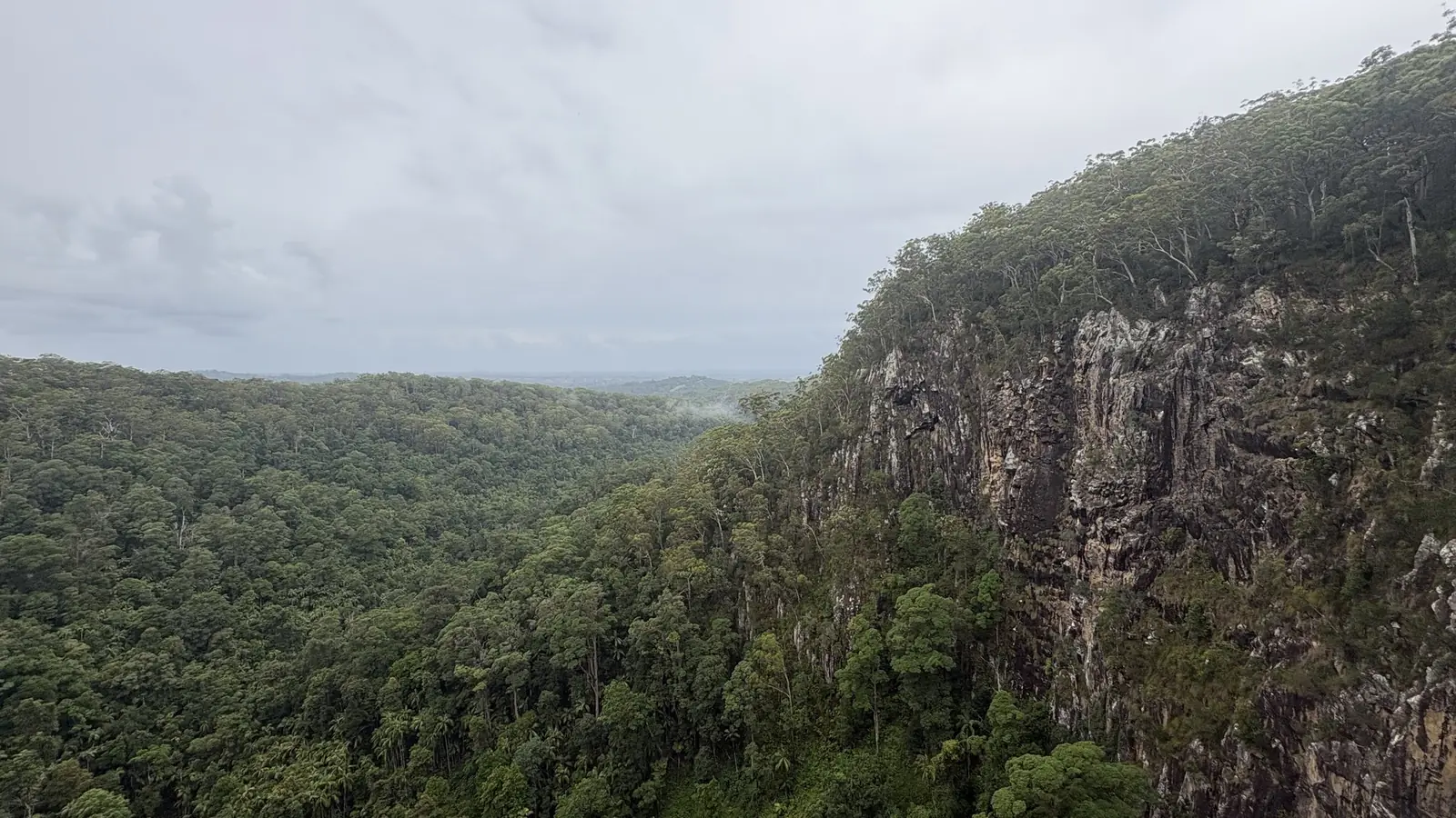
Photo: Aliceinthealice, CC0, via Wikimedia Commons.
Minyon Falls is one of the most dramatic waterfalls in the Northern Rivers. NSW National Parks and Wildlife Service (NPWS) says Repentance Creek "plunges over 100m", flowing over cliffs into a deep, palm-shaded gorge. The Minyon Falls walk takes you from the escarpment rim down to the base of the falls and back again, through rainforest and old-growth brushbox in World Heritage-listed Nightcap National Park. This guide covers the full walking track, the easy lookout, the Boggy Creek walk and nearby Protestors Falls, using NPWS track details checked on 25 October 2026.
Minyon Falls at a glance
| Walk | Distance | Time | Grade | Best for |
|---|---|---|---|---|
| Minyon Falls walking track | 13 km return | 3–4 hr | Grade 3 | The base of the falls |
| Minyon Falls lookout | Next to the car park | A few minutes | Easy | Views of the falls and valley |
| Boggy Creek walk | 4 km return | 1–2 hr | Grade 3 | Creek pools and families |
| Protestors Falls walking track | 1.4 km return | 1–1.5 hr | Grade 3 | A short rainforest waterfall walk |
The Minyon Falls walking track
Distance: 13 km return · Time: 3–4 hours · Grade: 3
NPWS describes the Minyon Falls walking track as leading through "a range of forests, pristine creeks and a spectacular waterfall". It winds through the Nightcap escarpment and dense rainforest. On the western side of Repentance Creek, look for the impressive stand of old-growth brushbox trees, and stop for lunch beside the fern-lined creeks.
Track conditions
The NPWS visitor info lists:
- Markings: clearly signposted
- Experience: some bushwalking experience recommended
- Gradient: short steep hills
- Steps: many steps
- Path: formed track with some obstacles
It's a proper bushwalk rather than a stroll. Wear sturdy shoes, carry plenty of water and allow the full 3–4 hours. NPWS also notes the walk is in a remote location where "weather can be unpredictable", so tell a family member or friend your plans.
Where to start
You can start from either picnic area: Minyon Falls (at the lookout, on the rim) or Minyon Grass (near the base of the falls). NPWS says Minyon Grass is quieter than the main lookout and has picnic tables and views of the cascading falls. Both have car and bus parking. NPWS warns parking can be limited on weekends and school and public holidays, so arrive early.
Minyon Falls lookout
If you're short on time, the Minyon Falls lookout is rated easy and has parking and picnic spots close by. From the platform, NPWS says you can admire the falls and the valley below. On a clear day you may see all the way to the coast. Blackbutt and scribbly gum forest the cliff tops.
Important: NPWS states there is no public access within 100 m of the top of Minyon Falls. Stay on formed tracks and at the lookout.
NPWS also notes Minyon Falls is a special place for the local Aboriginal community. Treat it with respect.
Boggy Creek walk
Distance: 4 km return · Time: 1–2 hours · Grade: 3
The Boggy Creek walk links Minyon Falls with Rummery Park campground in neighbouring Whian Whian State Conservation Area. It follows Boggy Creek through blackbutt forest, with turpentine, water gums, brushbox and flooded gum along the banks. NPWS describes it as a great walk for kids. It also says you can swim in the pools along the creek section, and that the cooler months are much quieter.
Rummery Park is also the base for overnight walkers on the Historic Nightcap walking track from Mount Nardi, about 18 km to the west, according to NPWS.
Protestors Falls walking track
Distance: 1.4 km return · Time: 1–1.5 hours · Grade: 3
Protestors Falls is at Terania Creek, in another part of Nightcap National Park near Lismore. NPWS says elevated boardwalk sections make it "an easy and enjoyable stroll" for families. The falls are named after the Terania Creek protests of the late 1970s, which saved this patch of rainforest. Sculptures at the start of the track tell that story.
Along the way, bangalow palms and native tamarind give way to yellow carabeen and strangler figs. Listen for the rose-crowned fruit dove, and keep an eye out for pademelons. The gravel creek beds are habitat for threatened frogs, including Fleay's barred frog and the pouched frog. NPWS asks walkers to avoid walking through creek beds. The area can close temporarily due to flash flooding during or after heavy rain.
About Nightcap National Park
Nightcap National Park is part of the Gondwana Rainforests of Australia World Heritage Area. NPWS describes it as "full of ancient rainforests, magical waterways and spectacular views". It's home to the nightcap oak and threatened animals such as Albert's lyrebird and Fleay's barred frog. From its escarpments, you can see the 20-million-year-old Wollumbin shield volcano. It's easy to reach from Lismore and Nimbin. NPWS says the park is always open but may close in poor weather, fire danger or for management operations.
Getting there
NPWS gives directions to the Minyon Falls section from three directions:
- From Bangalow: via Clunes, Rosebank and Repentance Creek Road, then Upper Coopers Creek Road and Minyon Falls Road (past Wren's Nest Cafe).
- From Lismore: via Dunoon and Dorroughby, then Nightcap Range Road through the Whian Whian SCA entrance to Minyon Drive.
- From Brisbane: exit the Pacific Highway south of Byron Bay onto Coolamon Scenic Drive. Head through Coorabell and Federal, then take Repentance Creek Road and Upper Coopers Creek Road to Minyon Falls Road.
Follow park signs from Minyon Drive. Mobile reception can be patchy in the hinterland, so download a map before you go.
When to walk Minyon Falls
NPWS advises that the falls "might not be flowing strongly" in a dry spell and are "at its most impressive after wet weather". It says Nightcap gets the highest annual rainfall in NSW: February is the wettest month and September the driest. Average temperatures are 18–29°C in summer and 6–19°C in winter.
Our pick is a dry, clear day soon after a good soaking. Check NPWS alerts before you go, because tracks such as Protestors Falls can close after heavy rain.
Rules and safety
- No pets, apart from certified assistance animals.
- No recreational drones in this area.
- No smoking in NSW national parks.
- Bring a hat, sunscreen, insect repellent and plenty of drinking water.
- Stay well back from the top of the falls. There's no public access within 100 m.
- Check the NSW National Parks alerts before you leave home.
Crossing the border from south-east Queensland? Browse the Active Quests trail list. It includes Gondwana rainforest walks such as the Border Track in Lamington. For a closer-to-home training walk, see our Mount Coot-tha Summit Track guide.
Related guides
- Border Ranges National Park: Best Walks & Pinnacle Lookout
- Byron Bay Lighthouse Walk: Cape Byron Track Guide
- Dorrigo National Park: Best Walks, Skywalk & Waterfalls
- Gold Coast Waterfall Walks
New NSW quests nearby
Frequently asked questions
How long is the Minyon Falls walk?
The Minyon Falls walking track is 13 km return and takes 3–4 hours. NPWS grades it Grade 3, with short steep hills and many steps.
Is the Minyon Falls walk hard?
It's moderate. The track is clearly signposted, but NPWS recommends some bushwalking experience because of the steep sections, many steps and some obstacles.
Can you swim at Minyon Falls?
NPWS says the pool at the base of the falls is a place to cool off, and you can swim in pools along Boggy Creek. There is no public access within 100 m of the top of the falls.
Can you see Minyon Falls without the long walk?
Yes. The Minyon Falls lookout is rated easy and sits near the picnic area and car park. It has views of the falls, the valley and, on clear days, the coast.
Where is Protestors Falls?
Protestors Falls is at Terania Creek in Nightcap National Park, near Lismore. The return walk is 1.4 km and takes 1–1.5 hours.
Are dogs allowed at Minyon Falls?
No. Pets aren't allowed in Nightcap National Park, apart from certified assistance animals.
Tours & experiences near Byron Bay
Make your next walk count
On Active Quests, each trail is a GPS check-in quest: walk it, check in on site and earn ACTIVE Coins. See the trails near you on the App Store.