
Border Ranges National Park: Best Walks and the Pinnacle Lookout
Published 26 October 2026
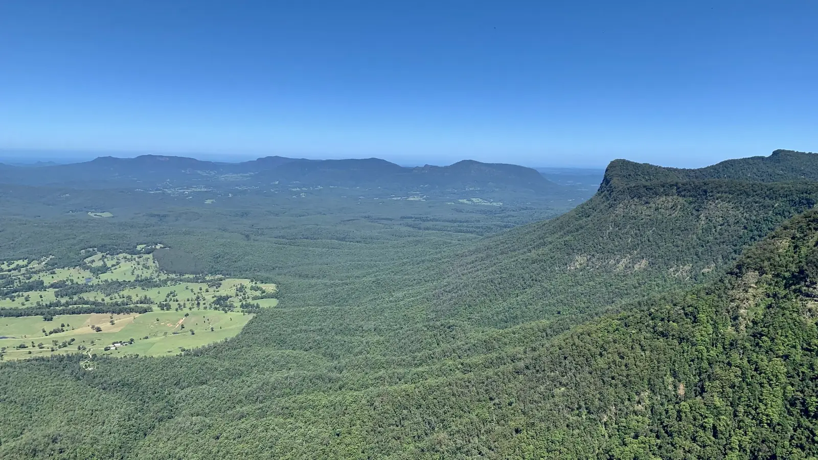
Photo: Ovico, CC BY-SA 4.0, via Wikimedia Commons.
NSW National Parks and Wildlife Service (NPWS) says Border Ranges National Park is part of the Gondwana Rainforests of Australia World Heritage Area. It's "a large area of wilderness that protects untouched rainforest and unique plants and animals connected to the ancient supercontinent of Gondwana". It sits on the NSW side of the McPherson Range, close to the Queensland border, so it's an easy weekend trip from south-east Queensland. This guide covers the Pinnacle lookout, the best short walks and longer creek hikes, using NPWS details checked on 25 October 2026.
Border Ranges walks at a glance
| Walk | Distance | Time | Grade | Highlight |
|---|---|---|---|---|
| Pinnacle walk and lookout | 0.6 km return | 30–45 min | Grade 2 | 360° views to Wollumbin and the coast |
| Border Loop walk | 1.5 km loop | 15–45 min | Grade 2 | Rainforest, koalas and the Spiral Loop railway |
| Red Cedar loop | 0.75 km loop | 20–40 min | Grade 2 | A 48 m red cedar |
| Falcorostrum loop | 0.65 km loop | 15–30 min | Grade 3 | Ancient Antarctic beech trees |
| Palm Forest walking track | 1 km one way | 30 min–1 hr | Grade 3 | Brushbox Falls lookout |
| Bar Mountain circuit | 4 km loop | 2–3 hr | Grade 3 | Views to Mount Lindesay and Mount Barney |
| Rosewood loop | 6 km loop | 1–2 hr | Grade 3 | Huge rosewood and white beech |
| Brindle Creek walking track | 6 km one way | 3–4 hr | Grade 3 | Waterfalls and Antarctic beech |
Pinnacle walk and lookout
0.6 km return · 30–45 minutes · Grade 2
NPWS says the Pinnacle walk and lookout is "one of the highlights of the whole park and not to be missed". It's a short walk through World Heritage rainforest to a lookout with 360° views over the park, the crater escarpment, Wollumbin (formerly Mount Warning), the Tweed Valley and out to the coast.
Go at sunrise. NPWS says it's "definitely worth making the effort" to see Wollumbin's silhouette at sunrise. Even though the walk is short, NPWS rates its accessibility as hard, so wear proper shoes.
Road note: the road to the Pinnacle is a well-maintained gravel road. However, NPWS warns that after heavy rain between December and May the surface can be rough or slippery in parts.
Border Loop walk and lookout
1.5 km loop · 15–45 minutes · Grade 2
The Border Loop walk is an easy stop on the Tweed Range Scenic Drive. It's a short circuit through rainforest that supports a population of koalas, so look high into the canopy. Track-side signs explain the ancient plants.
From Border Loop lookout you look south down Gradys Creek valley to the historic Spiral Loop railway, about 400 m below. NPWS says it was the first standard gauge railway linking two Australian capital cities. Construction of the Sydney–Brisbane line began after World War I. The lookout is rated easy and has picnic and barbecue facilities.
Short rainforest walks
Red Cedar loop
0.75 km loop · 20–40 minutes · Grade 2
The Red Cedar loop leads to the foot of a 48 m red cedar that NPWS says is possibly 1,000 years old. Look for bird's nest ferns, orchids and staghorns on the bark. It links nicely with the nearby Helmholtzia loop, which crosses Brindle Creek on low bridges and is named after the rare stream lily.
Falcorostrum loop walking track
0.65 km loop · 15–30 minutes · Grade 3
The Falcorostrum loop starts at Bar Mountain picnic area and winds through one of the park's largest stands of Antarctic beech. NPWS says this is the park's highest accessible point, at the same elevation as the summit of Wollumbin. Some trees may be 2,000 years old, and falcorostrum orchids grow on them; NPWS says this is the only place they're found. Albert's lyrebirds are common here, especially early in the morning or on overcast days.
Palm Forest walking track and Brushbox Falls
1 km one way · 30 minutes–1 hour · Grade 3
This easy track starts near Sheepstation Creek campground. It follows an old logging track through bangalow and piccabeen palms and brushbox estimated to be hundreds of years old, to Brushbox Falls lookout. Look for moss-covered carvings on a sandstone rock face north of the creek, where cedar getters carved their names. NPWS says the falls are most impressive in the late-summer wet season or after heavy rain.
Longer walks
Bar Mountain circuit
4 km loop · 2–3 hours · Grade 3
The Bar Mountain circuit descends a ridge beneath tall eucalypts to Bar Mountain lookout. NPWS says it has panoramic views of Collins Creek, Mount Lindesay and Mount Barney. You then return to the picnic area along the ridge past cliffs. The gravel access road can be rough after heavy rain between December and May.
Rosewood loop
6 km loop · 1–2 hours · Grade 3
Start at Sheepstation Creek campground and head north on the Palm Forest and Booyong tracks to a mountain creek for a paddle. About 2 km after the creek, look for signs to the Rosewood loop. It passes mature rosewood and white beech with huge buttress roots, which NPWS says often shelter sugar gliders and powerful owls.
Brindle Creek walking track
6 km one way · 3–4 hours · Grade 3
The Brindle Creek walking track runs from Brindle Creek picnic area to Antarctic Beech picnic area in the park's north-east. It passes huge hoop pines, lichen-covered Antarctic beech and helmholtzia lilies. NPWS calls the plateau "a cloud factory all year round", so you may walk in mist even in summer. Stop at Evans Falls, where NPWS says the swimming hole is ideal for a dip. Wipe off sunscreen and creams before swimming, because they can harm local frogs.
Planning your visit
- Getting there: NPWS says the park is near Murwillumbah and easily reached from Kyogle and Lismore. The Tweed Range Scenic Drive (part of the Rainforest Way) links the main stops.
- Fuel up first: NPWS says the closest service stations are in Kyogle, Woodenbong, Nimbin and Rathdowney.
- Fees: NPWS lists park entry fees for these areas. Check current fees on the Border Ranges National Park page before you go.
- Weather: NPWS warns it can be "extreme and unpredictable". Pack clothes for all conditions.
- Camping: NPWS lists campgrounds, including Sheepstation Creek and Forest Tops.
- No pets in NSW national parks, apart from certified assistance animals.
Queensland walks on the same range
The McPherson Range continues into Queensland's Lamington National Park. Walk the Gondwana rainforest on the Queensland side with the Border Track quest, or browse every Active Quests trail. For a closer training walk, read our Mount Coot-tha Summit Track guide.
Related guides
- Byron Bay Lighthouse Walk: Cape Byron Track Guide
- Dorrigo National Park: Best Walks, Skywalk & Waterfalls
- Minyon Falls Walk: Track Guide, Lookout & Tips
- Gold Coast Waterfall Walks
New NSW quests nearby
Staying on the Queensland side? Browse the Gold Coast walks and hiking trails hub or try the Twin Falls circuit at Springbrook.
Frequently asked questions
How long is the Pinnacle walk in Border Ranges National Park?
The Pinnacle walk is 0.6 km return and takes 30–45 minutes. It's Grade 2 and leads to 360° views of Wollumbin and the Tweed Valley.
Is the road to the Pinnacle lookout sealed?
No. NPWS says it's a well-maintained gravel road that can be rough or slippery after heavy rain between December and May.
Where is Border Ranges National Park?
It's in northern NSW, on the McPherson Range along the Queensland border. NPWS says it's near Murwillumbah and accessible from Kyogle and Lismore.
Do you need to pay to enter Border Ranges National Park?
NPWS lists park entry fees for the main walks and lookouts. Check the current fees on the NPWS park page before you visit.
What is the best walk in Border Ranges National Park?
For a short walk, the Pinnacle walk and lookout is the NPWS pick. For waterfalls and Antarctic beech, try the Brindle Creek walking track.
Can you swim in Border Ranges National Park?
NPWS says the swimming hole at Evans Falls on Brindle Creek is ideal for a dip. Wipe off sunscreen first to protect the frogs.
Tours & experiences near the Gold Coast
Walk it, check in, earn
Active Quests turns trail walks into GPS check-in quests where you earn ACTIVE Coins. Download it on the App Store.