
Mt Maroon Hike: Cotswold Summit Route Guide
Published 4 November 2026
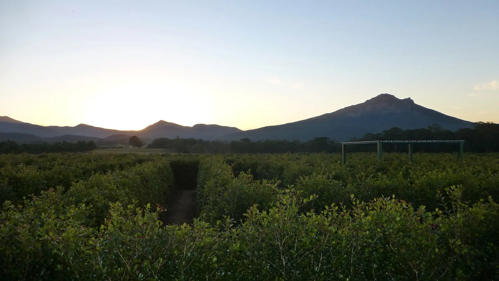
Photo: Mt Maroon from Lillydale Farm, by andredreyer, CC BY 3.0, via Wikimedia Commons. Cropped to fit.
Mt Maroon (966 m) is the craggy peak that watches over Lake Maroon in the Scenic Rim, about two hours' drive south-west of Brisbane. It sits in Mount Barney National Park and, like its bigger neighbour Mount Barney, it is a remnant of the ancient Focal Peak shield volcano. The climb from Cotswold Road is one of the most popular summit hikes in South East Queensland. It's shorter than Mount Barney, but it is still a real mountain route with rock scrambling, no formed track and a rockfall zone. This guide covers the route, how long it takes, where to park, the best season and how to stay safe.
Quick facts: Mt Maroon summit route
- Park: Mount Barney National Park, Scenic Rim, Queensland (managed by Queensland Parks and Wildlife Service).
- Start: Cotswold car park at the end of Cotswold Road, off the Boonah–Rathdowney Road near the village of Maroon.
- Summit: southern summit of Mt Maroon, 966 m.
- Time: QPWS says allow about 6 hours return. Fast, experienced groups take less, but plan for a full day.
- Distance: QPWS doesn't publish a distance. Walkers' GPS logs are usually about 4.5 to 5.5 km return, and our quest line is about 2.1 km each way.
- Climb: roughly 600 m of ascent from the car park to the summit.
- Difficulty: a summit route, not a walking track. It's unmarked, very steep in places and needs rock-scrambling skills and navigation.
- Best time: cooler, dry days, usually April to September. Spring brings wildflowers in the summit heath.
- Fees: none for day walking. Camping is not allowed on the summit.
Where is Mt Maroon and how do you get there?
Mt Maroon is on the northern edge of Mount Barney National Park, between Boonah and Rathdowney. Drive to Maroon on the Boonah–Rathdowney Road, then turn south onto Cotswold Road and follow it to the end, where there's a small car park and a gate near a farm dam. The summit route starts through the gate west of the car park.
Parking is limited and fills early on cool weekends, so arrive early, park considerately and don't block gates or driveways. The last part of the road is unsealed. For directions, maps and supplies, try the Boonah Visitor Information Centre or the Rathdowney Visitor Information Centre.
Want to tick it off in the app? Start the Mount Maroon Summit Route quest at the car park and check in at the GPS points on the way up.
The route, step by step
QPWS describes the route like this (Mount Barney things to do):
- The foothills. From the Cotswold car park the route rises gradually for about 400 m through open forest, then gets steeper.
- The north-east ridge. Follow the route up the north-east ridge. There are a few rock markers and cairns, but the route is unmarked and undefined, so carry GPS or a topographic map.
- The gorge and 'No waiting' zone. The route veers right and drops into a steep, narrow, rocky gorge. This is the lower end of the 'No waiting' zone, where there's a high risk of rockfall. Climb through without stopping, keep spacing between people and take care not to dislodge rocks onto anyone below.
- Montane heath and rock pavements. Above the gorge, the route crosses threatened montane heath and open rock slabs to the southern summit and its cairn.
From the top you look over Lake Maroon, Mount Barney, Mount Ernest, Mount Lindesay and the wider Scenic Rim. Return the same way. QPWS warns that descending can take twice as long as going up, so leave plenty of daylight.
How hard is the Mt Maroon hike?
It's the most approachable of the big Mount Barney summit climbs, but don't mistake it for a bushwalk. QPWS says summit routes are not walking tracks and are unsuitable for young children and people who can't climb unassisted. Expect:
- steep, loose and rocky ground for most of the climb
- hands-on scrambling in the gully and on the upper slabs
- no handrails, signs or formed track, and patchy or no phone coverage
- slippery rock when wet, and heat exposure with no water on the mountain.
If you're new to off-track walking, build up first on graded tracks such as the Yellow Pinch track (grade 4, 2 km return) or the Lower Portals walk, or go with a bushwalking club. QPWS recommends climbing with a capable, experienced leader.
Best time to climb Mt Maroon
QPWS advises walking in Mount Barney National Park during cooler weather, usually April to September. Summer heat is genuinely dangerous on this exposed rock, and there's no surface water. In spring the summit heath flowers against the craggy Scenic Rim peaks.
Check the Bureau of Meteorology forecast before you go. Never climb in wet weather or if rain is likely: wet rock is dangerously slippery and rain raises the chance of rockfall. Cloud and mist can roll in quickly and hide the route. If visibility drops, QPWS advises staying put until it clears.
Safety checklist
- Check Queensland park alerts for closures, fire management and track conditions. At the time of writing (4 November 2026) QPWS listed no alerts for Mount Barney National Park.
- Carry at least 3 litres of water each, food, a first-aid kit, a head torch and a warm layer.
- Wear sturdy shoes with good grip. Gloves help on the rough rock.
- Carry a GPS or a downloaded QTopo map, a charged phone and ideally a Personal Locator Beacon.
- Tell a reliable person your plan and when you'll be back.
- Start early, keep track of time and turn back if the group is struggling. It's often slower going down.
- Don't wait or rest in the 'No waiting' rockfall zone.
Our hiking essentials checklist has a full packing list.
Mt Maroon camping and where to stay
Camping is prohibited on the summit of Mt Maroon and within 600 m of the peak to protect the threatened montane heath. Plan it as a day climb.
There are no QPWS campgrounds at the Cotswold trailhead, but QPWS lists four privately run camping areas near the park, all with toilets, showers and barbecues: Mt Barney Lodge Country Retreat campground (near Yellow Pinch), Bigriggen Park, Flanagan Reserve and Lake Maroon Holiday Park. Book directly with the operators.
More walks around Mt Maroon
Make a weekend of it with other quests in the Scenic Rim walks and trails hub:
- Lower Portals walk: a 7.4 km return grade 4 track to a deep rock pool on Mount Barney Creek.
- Yellow Pinch track: a 2 km return grade 4 climb to a natural lookout facing Mount Barney.
- Mount Greville summit walk: another unmarked summit route, up palm-filled gorges in Moogerah Peaks National Park. QPWS says allow 5 to 6 hours return; experienced walkers only.
- Mee-bor-rum circuit at Mount French: a short grade 3 loop near Boonah (allow about 25 minutes).
- Queen Mary Falls circuit: a waterfall loop in Main Range National Park.
Planning more trips? See our guides to hikes near Brisbane, Lamington National Park trails, Girraween National Park and hiking for beginners.
Frequently asked questions
How long does the Mt Maroon hike take?
QPWS recommends allowing about 6 hours return from the Cotswold car park. Fit, experienced groups often take 4 to 5 hours, but plan for a full day and allow extra time for the descent.
How long is the Mt Maroon hike?
QPWS doesn't publish a distance for the summit route. GPS logs are usually about 4.5 to 5.5 km return, with roughly 600 m of climbing.
How hard is Mt Maroon?
It's a hard, unmarked summit route rather than a walking track. You need good fitness, rock-scrambling skills and navigation. It's unsuitable for young children and people who can't climb unassisted.
How high is Mt Maroon?
The southern summit of Mt Maroon is 966 m above sea level.
Where do you park for Mt Maroon?
Park at the Cotswold car park at the end of Cotswold Road, off the Boonah–Rathdowney Road near Maroon. Space is limited, so arrive early.
Can you camp on Mt Maroon?
No. Camping is prohibited on the summit and within 600 m of the peak. Privately run campgrounds nearby include Lake Maroon Holiday Park, Bigriggen Park, Flanagan Reserve and Mt Barney Lodge.
When is the best time to climb Mt Maroon?
On cool, dry days, usually April to September. Avoid hot days and never climb when it's wet, because the rock becomes slippery and rockfall is more likely.
Tours & experiences near the Scenic Rim
Earn as you explore
Active Quests turns walks into GPS check-in quests where you earn ACTIVE Coins on the trail. Get it on the App Store.